The (IMD) has issued an extensive forecast highlighting widespread rainfall, thunderstorms, and strong winds across multiple regions of the country through the end of October. As per the latest weather bulletin issued at 17:30 IST on October 25, 2025, two active weather systems, one depression over the east-central Arabian Sea and another in the southeast Bay of Bengal, are expected to dominate the country’s weather pattern over the next week.
The IMD has cautioned that the system over the Bay of Bengal is likely to intensify into a severe cyclonic storm by October 28, before making landfall along the Andhra Pradesh coast near Kakinada. Also, a fresh western disturbance will influence the western Himalayan region from October 27 onward, bringing light to moderate precipitation over the northwestern parts of the country.
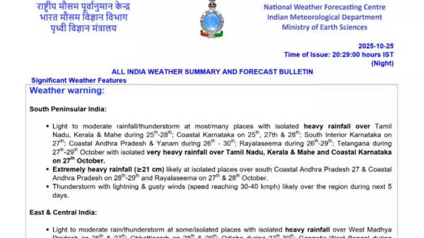
Heavy rainfall predicted over southern peninsulaSouthern peninsular India is expected to witness significant rainfall activity through the coming week. According to IMD, light to moderate rain or thunderstorms are likely at most places across Tamil Nadu, Kerala, Mahe, coastal and south interior regions of Karnataka, coastal Andhra Pradesh, Rayalaseema, and Telangana till October 30.
The forecast also highlights isolated heavy rainfall across these regions between October 26 and 29, with very heavy to extremely heavy rainfall (more than 21 cm) over south coastal Andhra Pradesh and Rayalaseema during October 27–29. Tamil Nadu, Kerala, and coastal Karnataka are also likely to experience very heavy rain on October 27.
Thunderstorms accompanied by lightning and gusty winds (30–40 kmph) are expected across the entire southern peninsula for the next five days. The IMD has advised residents and authorities to stay alert for potential flash floods, waterlogging, and local disruptions, especially in low-lying and coastal areas. Tourists are advised to plan their travel accordingly, and to avoid any unnecessary travel that may put them in risky situations.
East and central India to see intensified rainfallA spell of widespread rainfall is also on the horizon for east and central India, driven by the conditions of the Bay of Bengal system. The IMD predicts light to moderate rain and thunderstorms at several places across Odisha, Chhattisgarh, Jharkhand, West Bengal, and Bihar, extending till the end of the month.
Isolated heavy rainfall is also expected over parts of western Madhya Pradesh (October 26–27), Chhattisgarh (October 28–29), Odisha (October 27–30), Gangetic West Bengal (October 28–30), and Jharkhand (October 29–30). Meanwhile, sub-Himalayan West Bengal, Sikkim and Bihar may witness moderate to heavy precipitation between October 30–31.
The IMD has issued very heavy rainfall alerts for Odisha (October 27–29) and Chhattisgarh (October 29), while south Odisha is likely to receive extremely heavy rainfall (≥21 cm) on October 28–29.
Thunderstorms with lightning and gusty winds (30–50 kmph) are forecast over Odisha, Andaman & Nicobar Islands, and neighbouring states, with lightning activity also anticipated across Madhya Pradesh, Vidarbha, and Chhattisgarh throughout the week.
The IMD has warned that such conditions may lead to localised flooding, waterlogging, and landslides in hilly terrain, while strong winds could cause minor structural damage and crop losses in some agricultural areas.
Western India to experience showers and lightningParts of Western India, especially the Konkan and Goa region, parts of central Maharashtra, and Gujarat, are expected to receive light to moderate rainfall through October 28. Isolated heavy showers are predicted over these regions on October 27 and 28. .
Notably, the Saurashtra region could experience very heavy rainfall on October 26 as a result of the Arabian Sea depression. Accompanying these rains, thunderstorms with lightning are likely across the western coastal belt for the next four to five days.
The IMD has also issued warnings for squally winds over the northeast Arabian Sea, particularly off the Maharashtra-Gujarat coasts, with wind speeds ranging from 35–55 kmph, gusting up to 65 kmph at times. Fishermen have been advised not to venture into the sea, given the rough sea conditions and potential for high waves.
Northeast India to witness a wet spell toward month-endNortheastern states are expected to experience a gradual increase in rainfall activity starting October 29. The IMD predicts light to moderate rain and thunderstorms at several places across Assam and Meghalaya, Nagaland, Manipur, Mizoram, and Tripura from October 29–31. Arunachal Pradesh is likely to see rain and thundershowers on October 30.
Isolated heavy rainfall is also on the forecast for Assam and Meghalaya and adjoining northeastern states during this period, marking the onset of a wet spell that could extend into early November.
Northwest India to receive scattered rainfallThe western parts of Rajasthan will also experience light to moderate rain or thunderstorms between October 26 and 28, influenced by the approaching western disturbance. East Rajasthan could see isolated heavy rainfall on October 27, though it is expected to be short-lived.
Overall, rainfall activity over Northwest India, including the plains of Punjab, Haryana, Delhi, and western Uttar Pradesh, is likely to remain limited, except for occasional showers under the influence of passing systems.
Daily forecasts October 26Heavy to very heavy rainfall is expected over Andaman and Nicobar Islands, Saurashtra and Kutch, and isolated heavy rain over Andhra Pradesh, Gujarat, Kerala, Tamil Nadu, and West Madhya Pradesh. Squally winds (35–55 kmph) are forecast over the Arabian Sea, while gale winds (up to 80 kmph) will affect the Bay of Bengal by evening.
October 27Extremely heavy rainfall is predicted over Andhra Pradesh, along with very heavy rain over coastal Karnataka, Kerala, Odisha, and Tamil Nadu. Thunderstorms with gusty winds (40–50 kmph) are expected across Andaman and Nicobar, Kerala, and Mahe. The Bay of Bengal system is projected to generate gale-force winds (up to 100 kmph).
October 28The system over the Bay of Bengal is likely to intensify further, bringing extremely heavy rain to Andhra Pradesh and Odisha. Heavy rainfall is also forecast for Chhattisgarh, coastal Karnataka, and Kerala. Gale winds may reach 90–100 kmph over the west-central Bay of Bengal.
October 29Rainfall activity will persist with very heavy to extremely heavy rain over coastal Andhra Pradesh, Odisha, and Chhattisgarh. The northeastern states will begin to receive rain, with Assam and Meghalaya, Nagaland, Manipur, Mizoram, and Tripura all expected to experience heavy downpours.
October 30–31Rainfall will gradually shift towards eastern and northeastern India. Heavy showers are expected over Assam, Meghalaya, Bihar, Jharkhand, and West Bengal, with light to moderate rain continuing over the remaining regions.
Cyclonic activity and wind warningsThe depression over the southeast Bay of Bengal remains the primary system of concern. As per the IMD, it will intensify into a cyclonic storm and subsequently into a severe cyclonic storm by October 28, before moving northwestward to cross the Andhra Pradesh coast near Kakinada.
Gale-force winds of 80–100 kmph are anticipated in the west-central and northwest Bay of Bengal, while squally winds (40–60 kmph) will impact south Odisha, Andhra Pradesh-Yanam coasts, and adjoining sea areas. Fishermen have been strictly warned to avoid venturing into the sea along these coasts through October 29.
Contact to : xlf550402@gmail.com
Copyright © boyuanhulian 2020 - 2023. All Right Reserved.